Code
Name
Info
Sample Picture
& Nav
Take a picture of the Information sign on the west side of the dam with your bike and rally flag in the picture.
Cougar Dam forms Cougar reservoir on the south fork of the McKenzie River. It is a rock-filled embankment dam that stands 519 feet tall and about 1,600 feet wide.


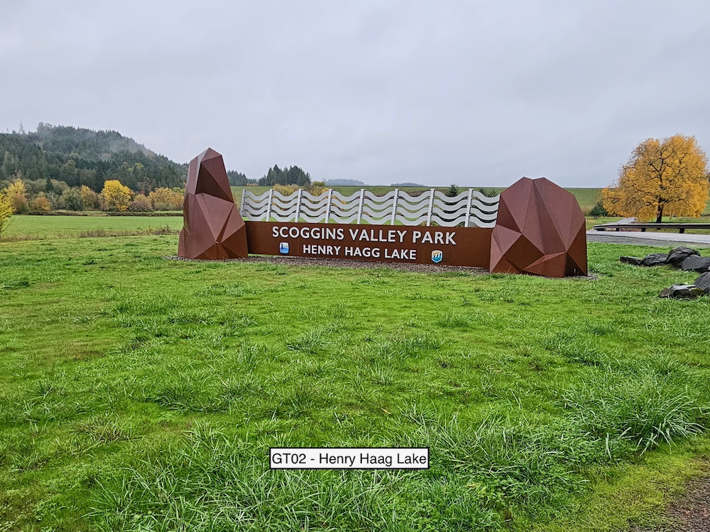
Take a picture of the Scoggins Valley Park sign in the parking area with your bike and flag in the picture.
Henry Hagg Lake is formed by the Scoggins Dam and is a popular recreation area for local fishermen. Scroggins Dam is a earth-fill embankment dam that stands about 151 feet high and is about 2,700 feet long.
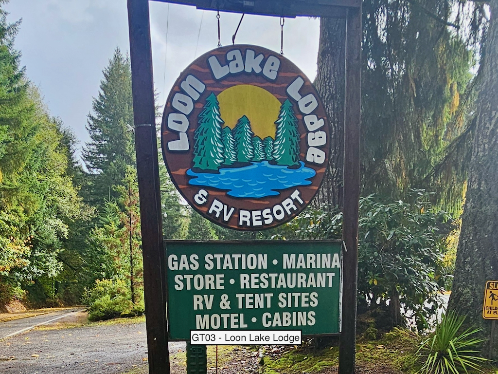
Take a picture of the Loon Lake Lodge sign with your bike and flag in the picture.
Loon Lake was formed by a landslide about 1,400 years ago. Not a man-made dam, but a dam nonetheless!
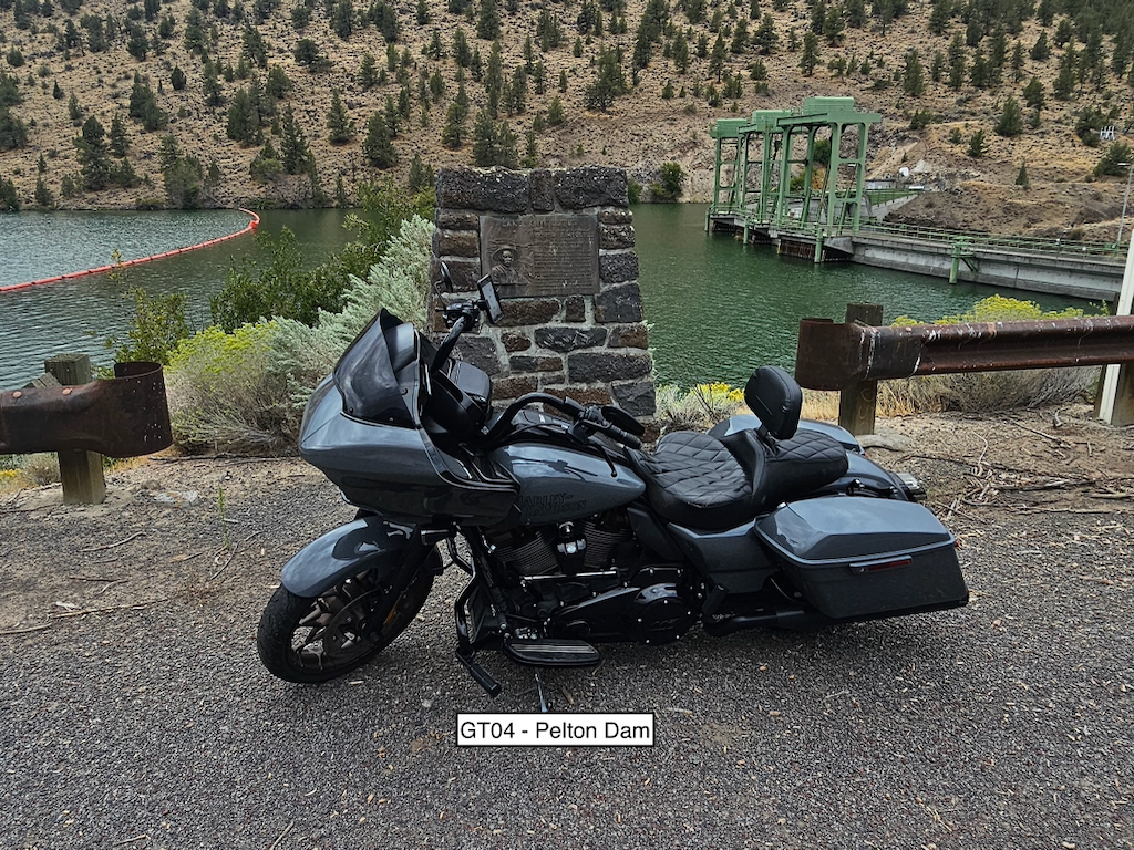
Take a picture of the Lake Simtustus historical marker with your bike and flag in the picture.
Pelton Dam forms Lake Simtustus on the Deschutes River. The dam is a concrete arch hydro dam that stands about 204 feet tall and is about 965 feet long. Go a little farther south on Pelton Dam Road for a good view of Herbers Canyon.
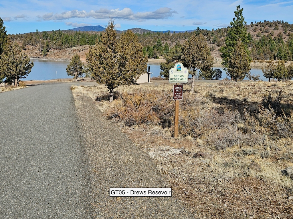
Take a picture of the Drews Reservoir sign with your bike and flag in the picture.
The sign is located on the road down to the boat ramp. Drews Reservoir is formed by Drews Dam, a small rockfill irrigation dam. The dam is about 60 feet tall and 600 feet long.
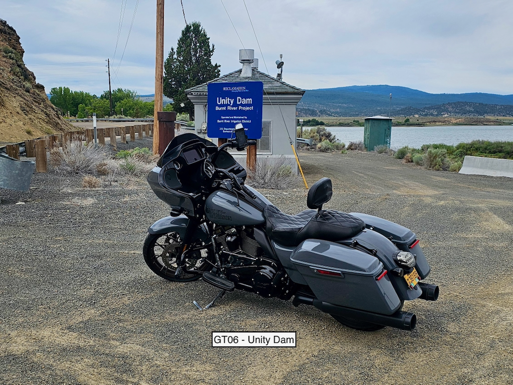
Take a picture of the Unity Dam sign with your bike and flag in the picture.
Unity Reservoir is formed by Unity Dam on the Burnt River. It is an earth-fill dam about 82 feet high and 694 feet long.
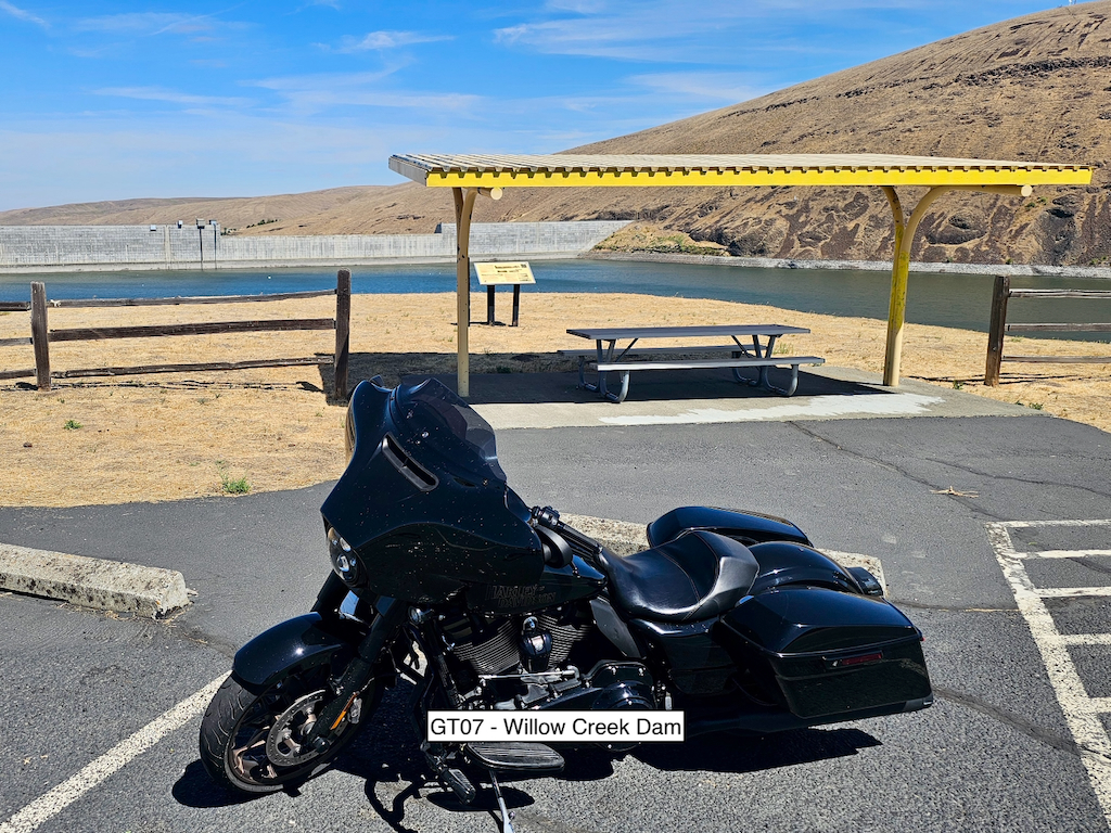
Take a picture of the covered picnic area at Willow Creek Dam with your bike and flag in the picture.
OR-74 is a rider's favorite and should be a blast! Willow Creek Dam forms Willow Creek Lake on Willow Creek... see a trend here??? It is a concrete dam about 160 feet high and about 1,780 feet long.
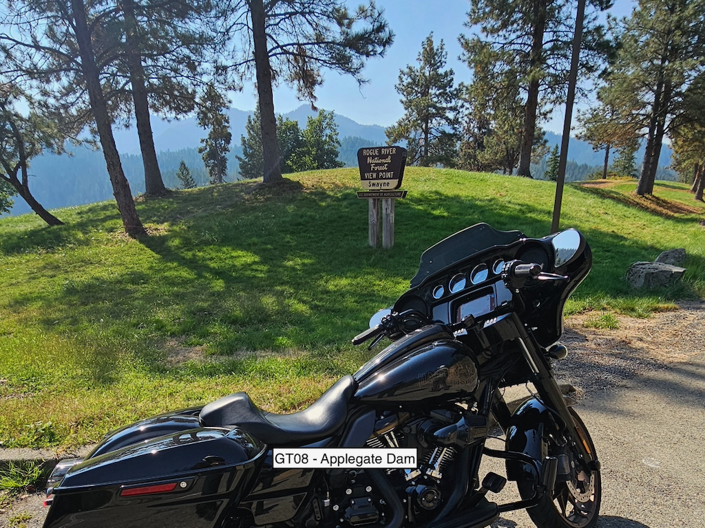
Take a picture of the Swayne View Point sign with your bike and flag in the picture.
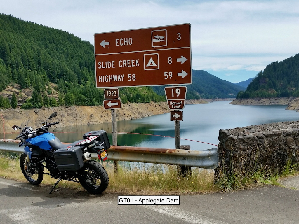
The sign is located at the turn into the view point. The dam lays on the Applegate River and forms Applegate Lake. It is a large rockfall embankment dam about 242 feet high and 1,300 feet long.
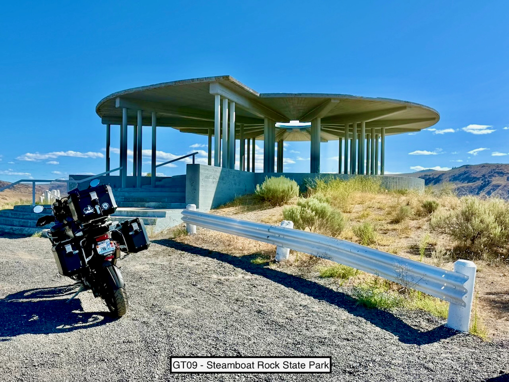
Take a picture of the covered observation platform with your bike and flag in the picture.
Wait! I thought you said the theme was dams this year??? Go there and take a look at one of the most magnificent dams in the entire PNW from a new vantage point. Grand Coulee Dam is a concrete gravity hydro dam that stands 550 feet tall and is about 5,223 feet across!
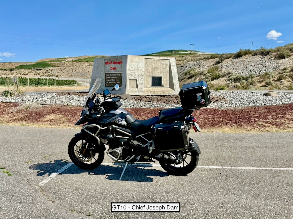
Take a picture of the Chief Joseph Dam sign with your bike and flag in the picture.
Chief Joseph Dam sits on the Columbia River. It is a concrete gravity hydro dam that stands about 236 feet tall and is about 5,600 feet across. Chief Joseph is the second largest power producer in the US - only Grand Coulee exceeds it.
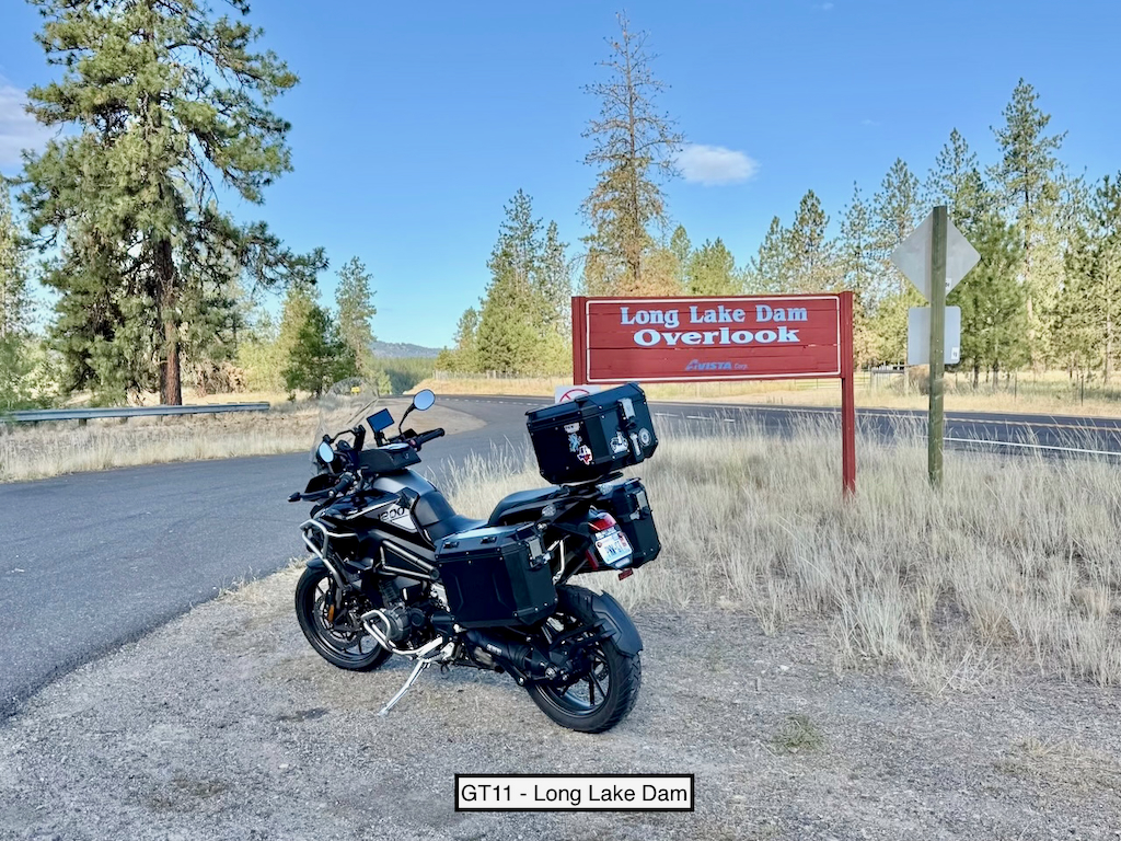
Take a picture of the Long Lake Dam Overlook sign in the parking area with your bike and flag in the picture.
Long Lake Dam lays on the Spokane River west of Spokane on one of the better roads out of town. It is a concrete gravity hydro dam that stands 223 feet high and is about 725 feet across. The overlook provides a great view of the dam.
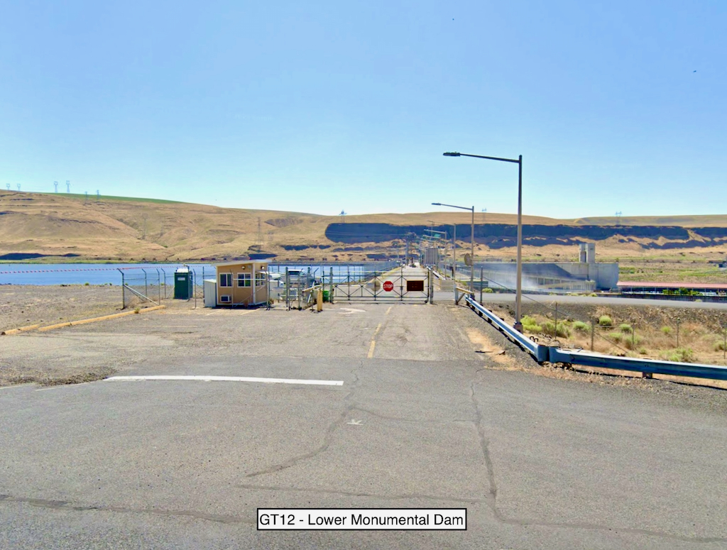
Take a picture of the Lower Monumental Dam (either side) with your bike and flag in the picture.
Lower Monumental Dam lays on the Snake River. You can ride across the dam, but there are some restrictions and it may only be an option between 7:30 and 4:30. We are giving you the option of taking a picture from either side the dam. The dam is a concrete gravity hydro dam that stands 100 feet high and is about 2,248 feet across.
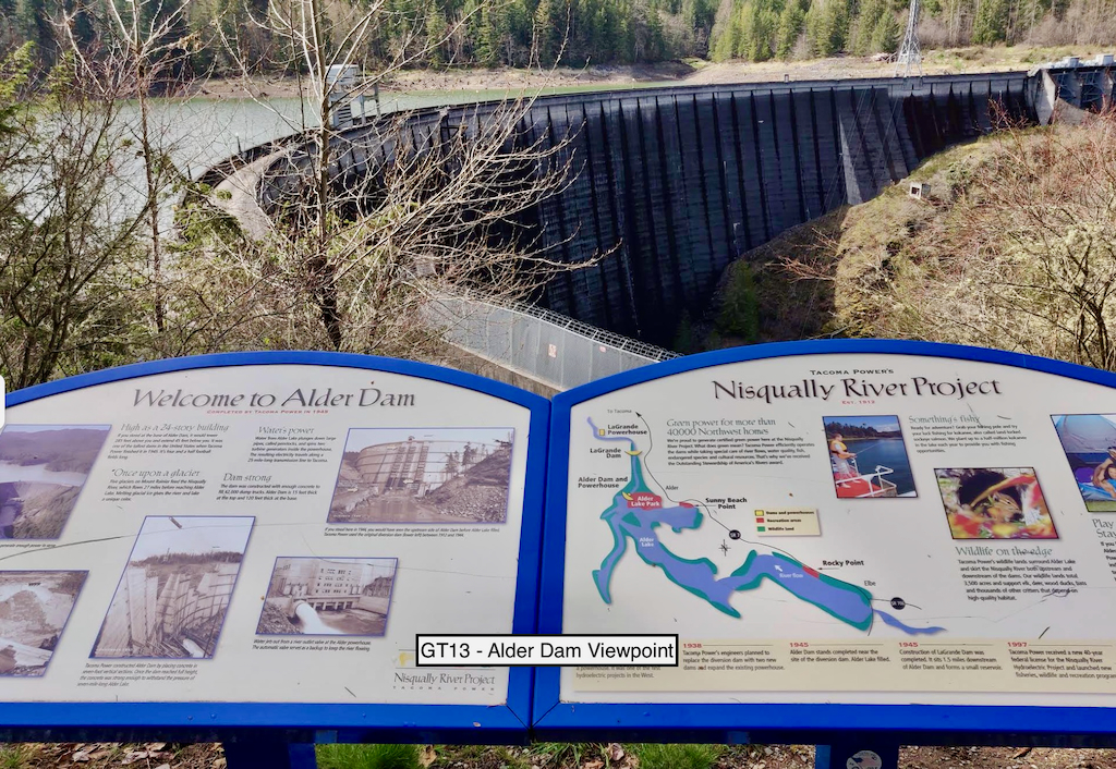
Take a picture of Alder Dam with your bike and flag in the picture. NOTE: If they are charging an entrance fee, you may take a picture of the entrance booth instead.
Alder Dam is a concrete gravity hydro dam located on the Nisqually River. It stands about 330 feet tall and is about 1,370 feet across.
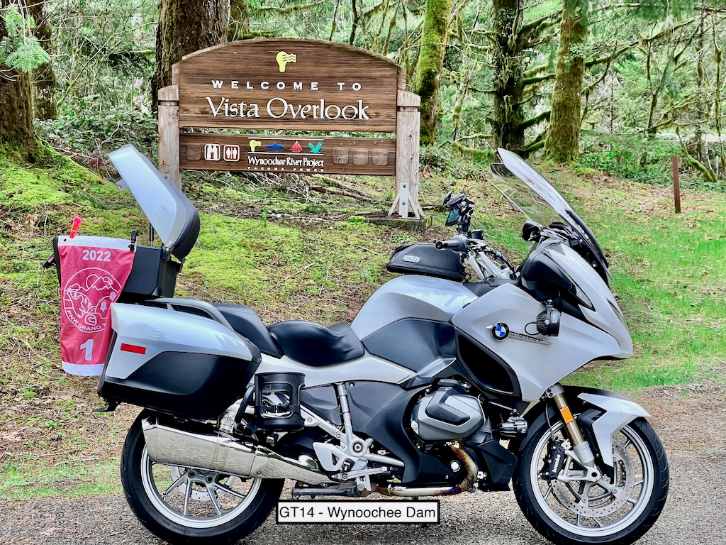
Take a picture of the Wynoochee Dam Overlook sign with your bike and flag in the picture.
OK, we have used this one before, but the area is a fun ride and we have lots of new riders, so here we go! Wynoochee Valley Road is paved all the way to the sign from Montesano. There are other routes to the sign, but they all involve dirt. If you want the dirt...follow NF-22 from the dam back to US-101 north of Aberdeen. The dam is a concrete double-curvature arch dam that stands about 155 feet tall and is about 650 feet across.
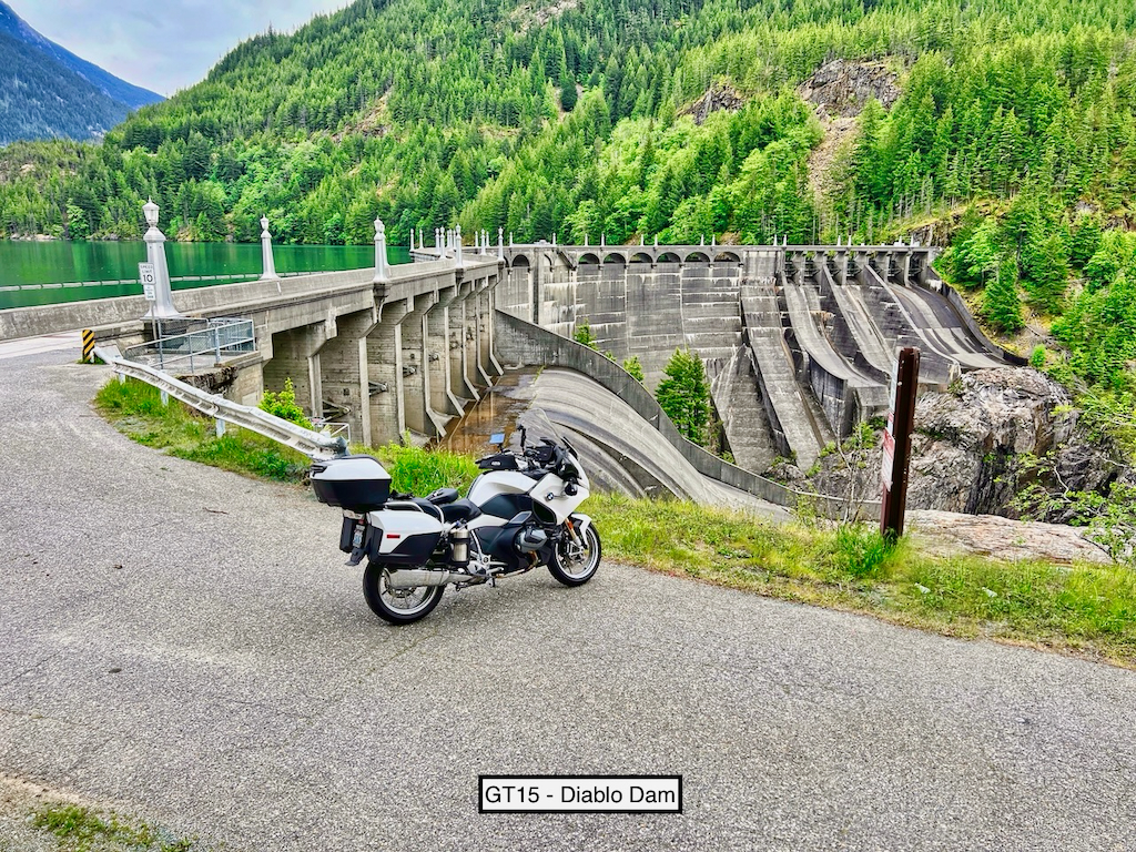
Take a picture of Diablo Dam with your bike and flag in the picture.
Some of you will curse me when you arrive only to find out the road to the dam is closed...read on! You can access and drive over the dam between the hours of 7:30am and 5:00pm (typically). The dam is a concrete arch hydro dam that stands 389 feet tall and is about 1,000 feet across.
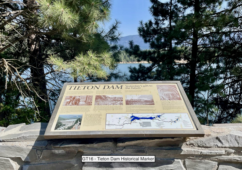
Take a picture of the Tieton Dam Historical Marker sign with your bike and flag in the picture.
The sign is located in a turnout along US-12. The dam forms Rimrock Lake along the Tieton River. Tieton dam is an earth fill embankment irrigation dam that stands about 262 feet tall and is about 1,110 feet across.
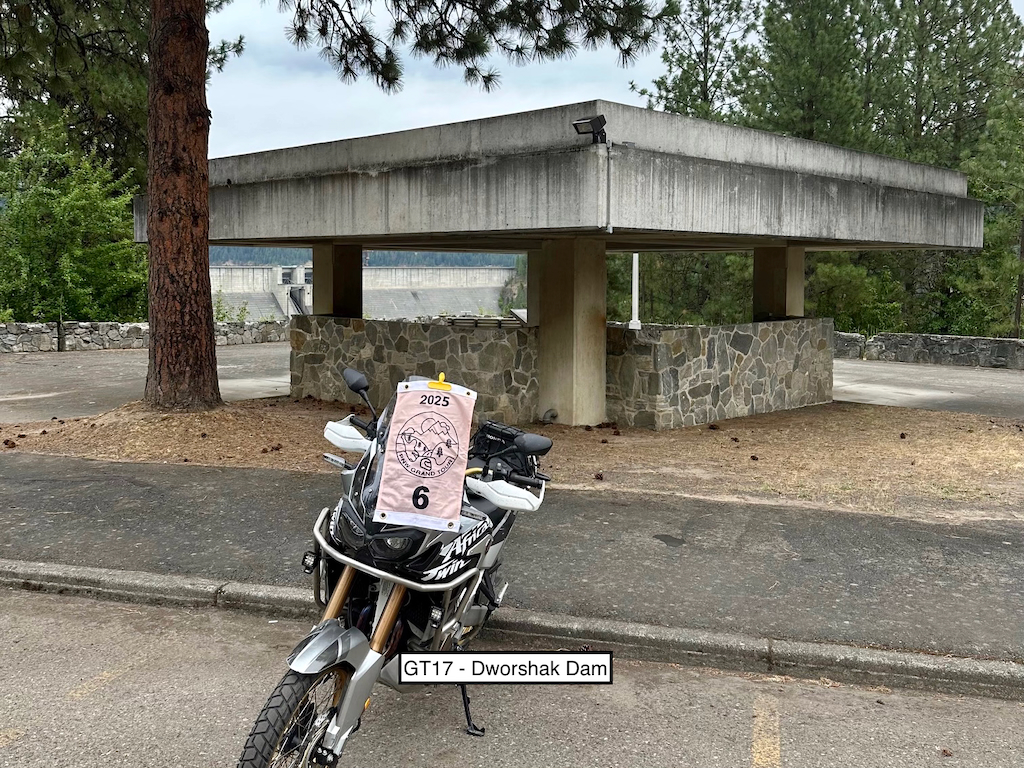
Take a picture of the covered pavilion in the parking area before the visitor center with your bike and flag in the picture.
Dworshak Dam lays on the north fork of the Clearwater River and forms Dworshak Reservoir. It is the third tallest dam in the US at 717 feet and is roughly 3,287 feet long. Continue up the road to the visitor center for great views of the dam.
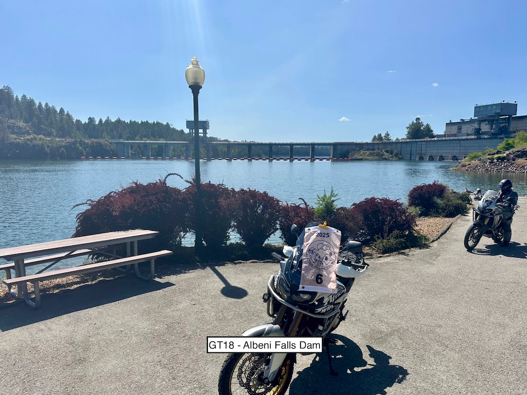
Take a picture of Albeni Falls Dam with your bike and flag in the picture.
Albeni Falls Dam sits on the Pend Oreille River and is used to generate electricity and provide flood control. The dam is a concrete structure 90 feet tall and about 1,000 feet long.
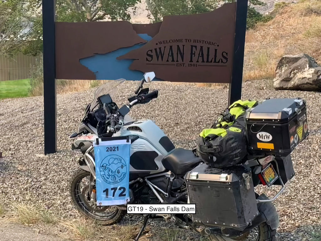
Take a picture of the Swan Falls sign near the dam with your bike and flag in the picture.
Swan Falls Dam sits on the Snake River in southwest Idaho. It is a concrete gravity hydro dam that is about 100 feet tall and roughly 1,150 feet long. There are some really great views of the dam, Snake River and canyon on your way down to the dam.
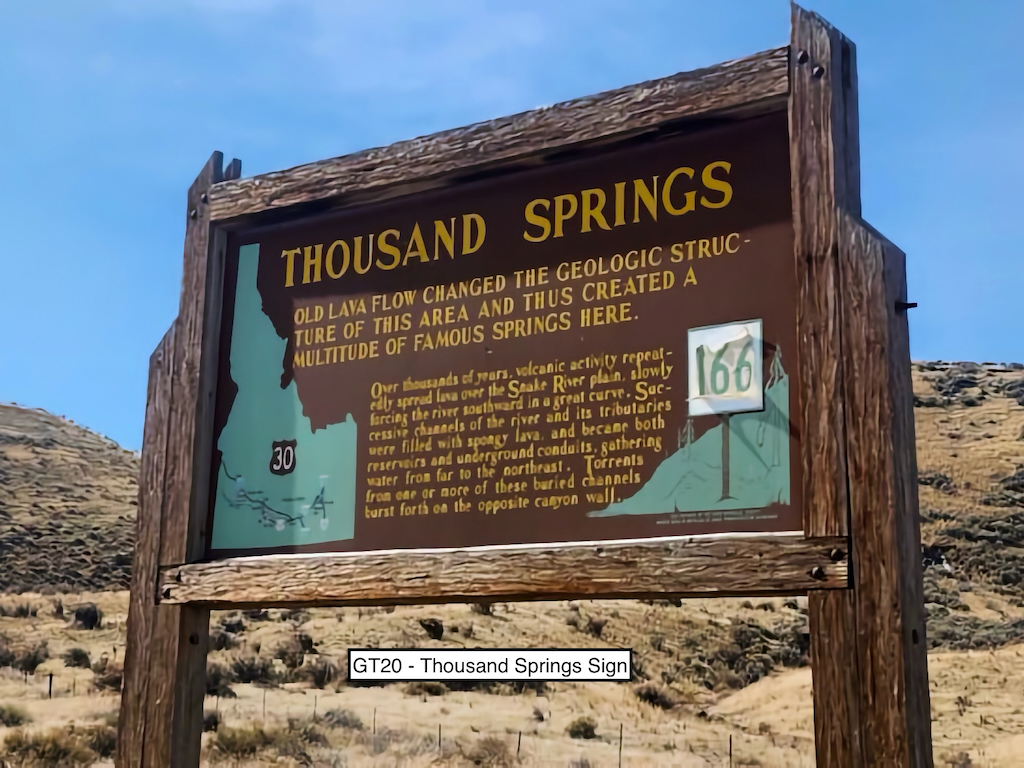
Take a picture of the Thousand Springs Historical sign with your bike and flag in the picture.
But it's not a dam? OK, you got us. But it is close to a dam we wanted to use...sadly, a little too much dirt for most of our riders, though. The Malad River Gorge dam is located at N42.86366, W114.88475 if you want to brave the dirt road and take a look.
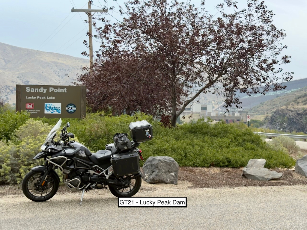
Take a picture of the Sandy Point sign with your bike and flag in the picture.
Lucky Peak Dam sits on the Boise River and forms Lucky Peak Lake. It is a rolled earth fill embankment dam that is about 250 feet tall and 1,700 feet long.
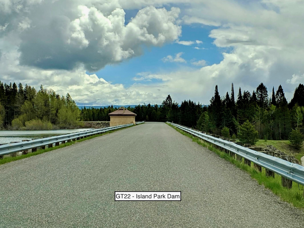
Take a picture of the Island Park Dam with your bike and flag in the picture.
Island Park Dam sits on the Henrys Fork of the Snake River and forms Island Park Reservoir. It is a zoned earth fill dam that is 94 feet tall and roughly 9,500 feet long.
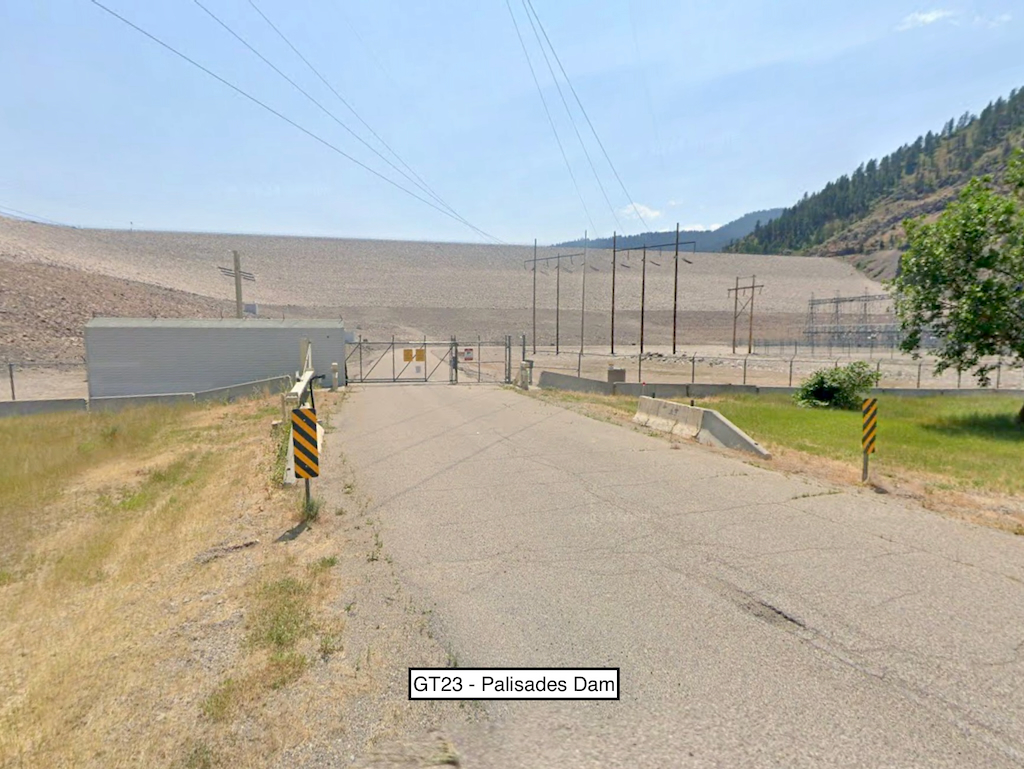
Take a picture of the Palisades Dam with your bike and flag in the picture.
Palisades Dam sits on the south fork of the Snake River and forms Palisades Reservoir. It is a large earth-fill dam that is 270 feet tall and roughly 2,100 feet long. The sample picture is from the area at the bottom (downstream) of the dam. There is an access road off of US-20 to get there.
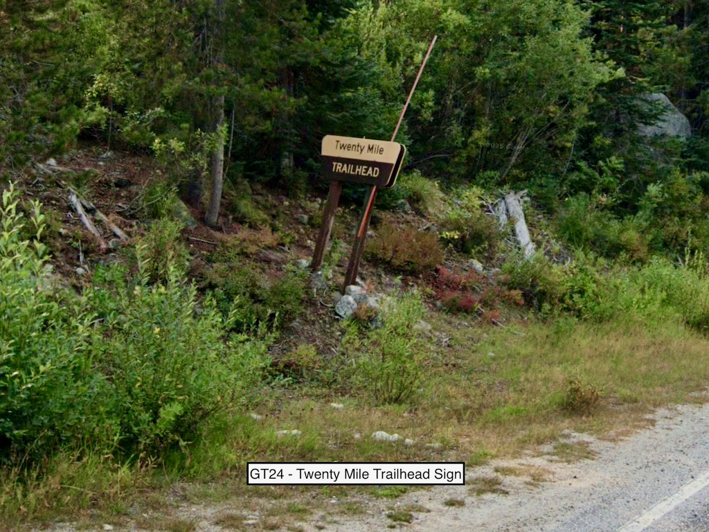
Take a picture of the Twenty Mile Lakes Trailhead sign with your bike and flag in the picture.
No, there isn't a dam nearby. But it is beautiful up in this area and we really wanted you to go!
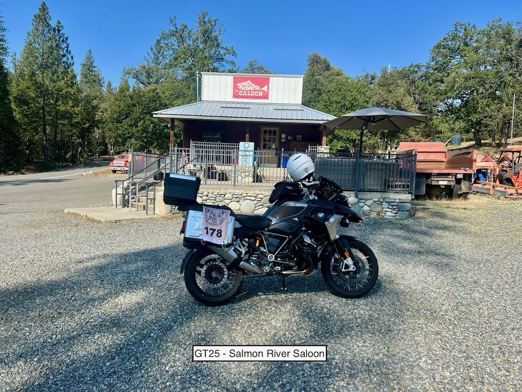
Take a picture of the Salmon River Saloon with your bike and flag in the picture.
Yup, no dam here. But Cecilville Road should be a fun ride along portions of the Salmon River. Cecilville is pretty remote and while there is a gas station shown in town on Google Maps, it usually only operates Friday - Sunday. Gas up before you head towards this stop!
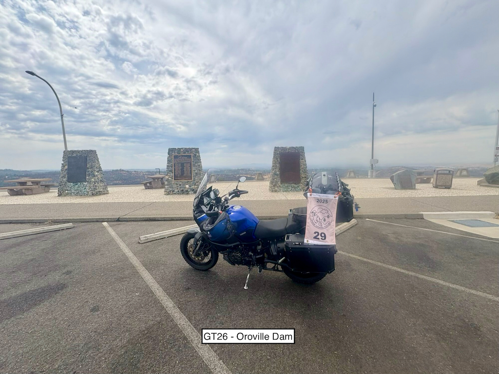
Take a picture of the historical markers in the parking area at the dam with your bike and flag in the picture.
Oroville Dam sits on the Feather River and forms Lake Oroville. The dam is the tallest in the US at 770 feet. The dam is pretty famous for the big spillway crisis back in 2017. You might want to pack your swimsuit if you visit in late summer...
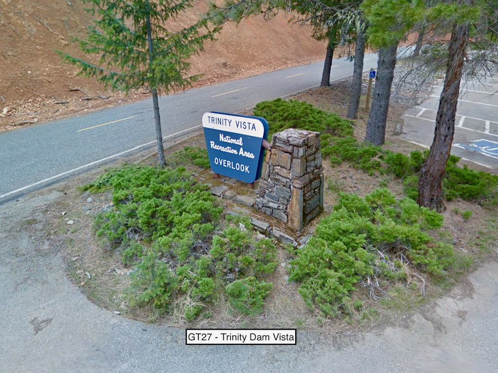
Take a picture of the Trinity Vista sign with your bike and flag in the picture.
Trinity Dam sits on Trinity River and forms Trinity Lake. At 538 feet tall, it is one of the tallest earth fill dams in the US. The Trinity Vista provides some pretty awesome views of the reservoir and dam.
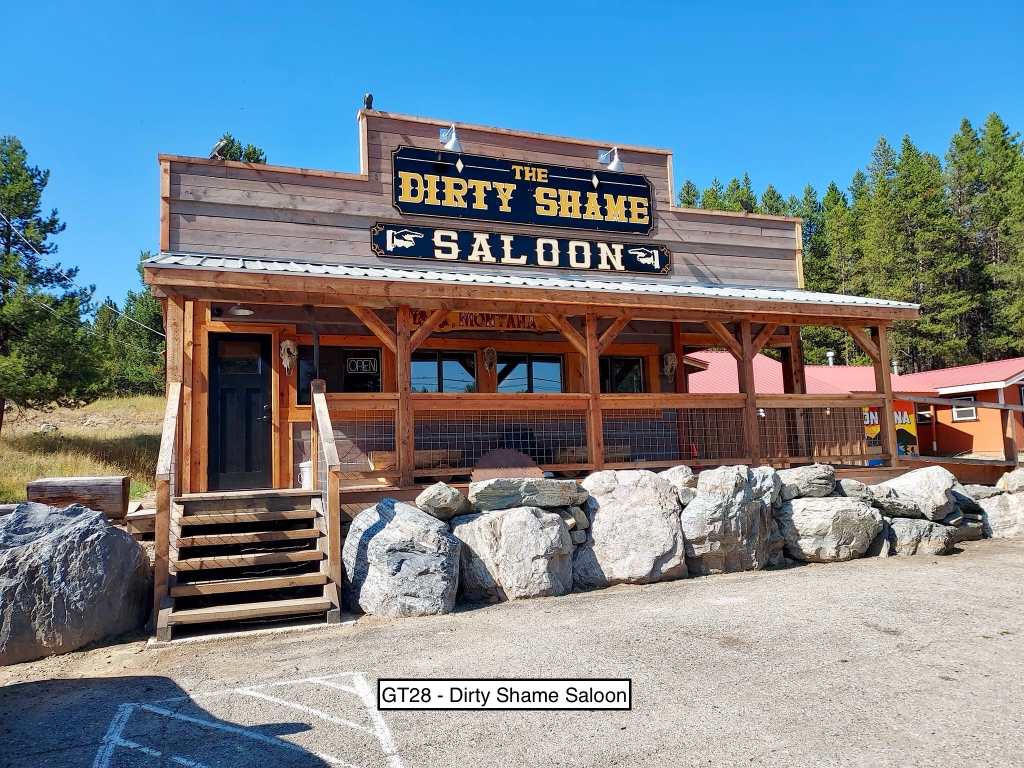
Take a picture of the Dirty Shame Saloon with your bike and flag in the picture.
No dam nearby, but the ride will be a very fun trip!
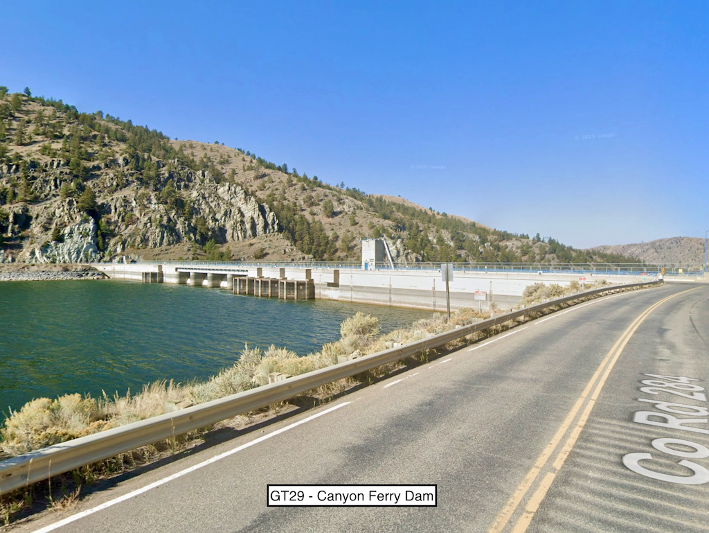
Take a picture of the Canyon Ferry Dam with your bike and flag in the picture.
Canyon Ferry Dam sits on the Missouri River. It is a concrete gravity dam. The creation of Canyon Ferry Lake submerged the historical town of Canton.
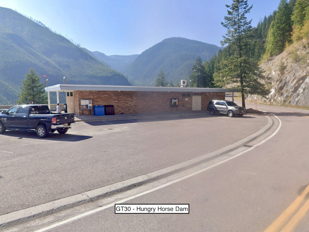
Take a picture of the Hungry Horse Dam visitor center with your bike and flag in the picture.
Hungry Horse Dam sits on the south fork of the Flathead River and forms Hungry Horse Reservoir. It is a large concrete arch dam that stands roughly 564 feet tall - the tallest in Montana and one of the tallest in the US.
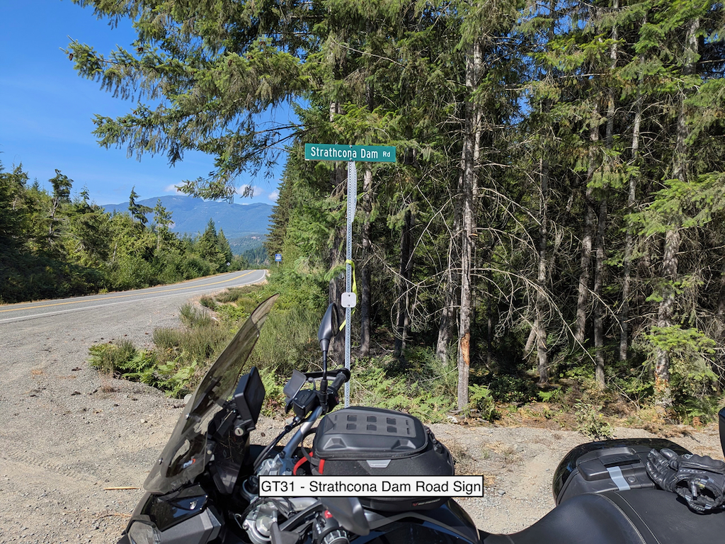
Take a picture of the Strathcona Dam Road sign with your bike and flag in the picture.
Go to Vancouver Island. Ride all day. This is the recipe for peace and tranquility. Strathcona dam is an earth fill hydro dam that sits on the Campbell River. The actual dam requires dirt roads - the sign is on a paved road. Continue on the Gold River Highway to Gold River or you will be judged...
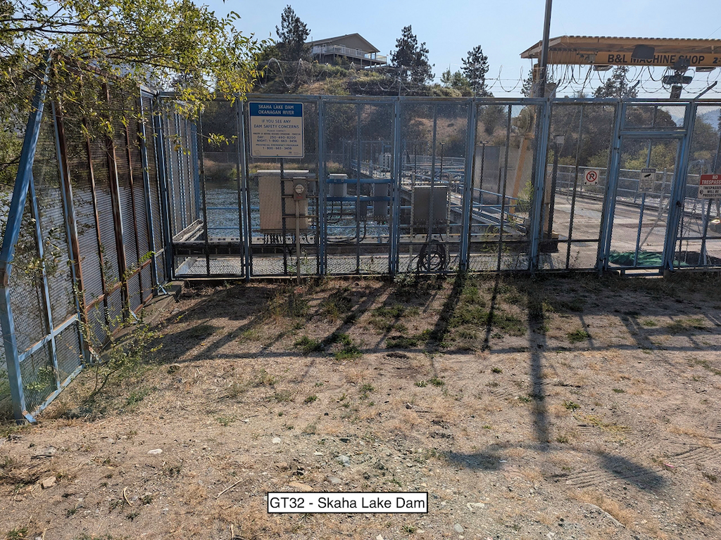
Take a picture of Skaha Lake Dam with your bike and flag in the picture.
Skaha Dam sits on the Okanagan River and forms Skaha Lake. The dam is a small concrete control dam that is roughly 30 feet tall and 350 feet long. Good riding lays in all directions.
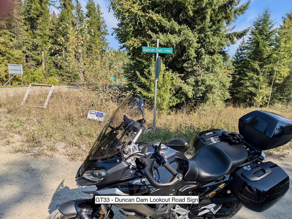
Take a picture of the Duncan Dam Lookout Road sign with your bike and flag in the picture.
This sign is at the intersection of Duncan Dam Lookout Road and highway 31. The dam lookout is at the end of a dirt road that is pretty well maintained, so go there if you want great views! The dam sits on the Duncan River and is an earth fill embankment dam. It is about 131 feet tall and 3,600 feet long.